Geoscience Knowledge Sharing
Type of resources
Keywords
Publication year
Topics
-
The Exploring for the Future program Showcase 2023 was held on 15-17 August 2023. Day 2 - 16th August talks included: Highways to Discovery and Understanding Session AusAEM - Unraveling Australia's Landscape with Airborne Electromagnetics – Dr Yusen Ley Cooper Exploring for the Future Data Discovery Portal: A scenic tour – Simon van der Wielen Towards equitable access to regional geoscience information– Dr Kathryn Waltenberg Community engagement and geoscience knowledge sharing: towards inclusive national data and knowledge provision – Dr Meredith Orr Foundational Geoscience Session The power of national scale geological mapping – Dr Eloise Beyer New surface mineralogical and geochemical maps of Australia – Dr Patrice de Caritat Imaging Australia’s Lithospheric Architecture – Dr Babak Hejrani Metallogenic Potential of the Delamerian Margin– Dr Yanbo Cheng You can access the recording of the talks from YouTube here: <a href="https://youtu.be/ZPp2sv2nuXI">2023 Showcase Day 2 - Part 1</a> <a href="https://youtu.be/dvqP8Z5yVtY">2023 Showcase Day 2 - Part 2</a>
-
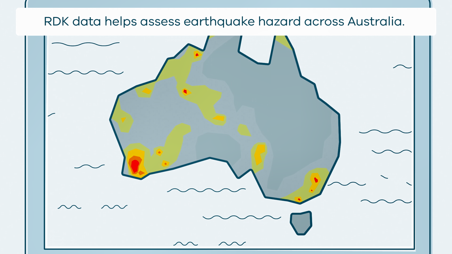
This animation shows what happens when rapid deployment kits (RDKs) are deployed after an earthquake. It is part of a series of Field Activity Technique Engagement Animations. The target audience are the communities that are impacted by GA's data acquisition activities. There is no sound or voice over. The 2D animation includes a simplified view of what rapid deployment kits (RDKs) look like, what is measured, and how scientists use the data.
-
This animation shows how Magnetotelluric (MT) Surveys Work. It is part of a series of Field Activity Technique Engagement Animations. The target audience are the communities that are impacted by our data acquisition activities. There is no sound or voice over. The 2D animation includes a simplified view of what magnetotelluric (MT) stations and equipment looks like what the equipment measures and how the survey works.
-
This animation shows how Airborne Electromagnetic Surveys Work. It is part of a series of Field Activity Technique Engagement Animations. The target audience are the communities that are impacted by our data acquisition activities. There is no sound or voice over. The 2D animations include a simplified view of what AEM equipment looks like, what the equipment measures and how the survey works.
-
The Exploring for the Future program Showcase 2023 was held on 15-17 August 2023. Day 1 - 15th August talks included: Resourcing net zero – Dr Andrew Heap Our Geoscience Journey – Dr Karol Czarnota You can access the recording of the talks from YouTube here: <a href="https://youtu.be/uWMZBg4IK3g">2023 Showcase Day 1</a>
-
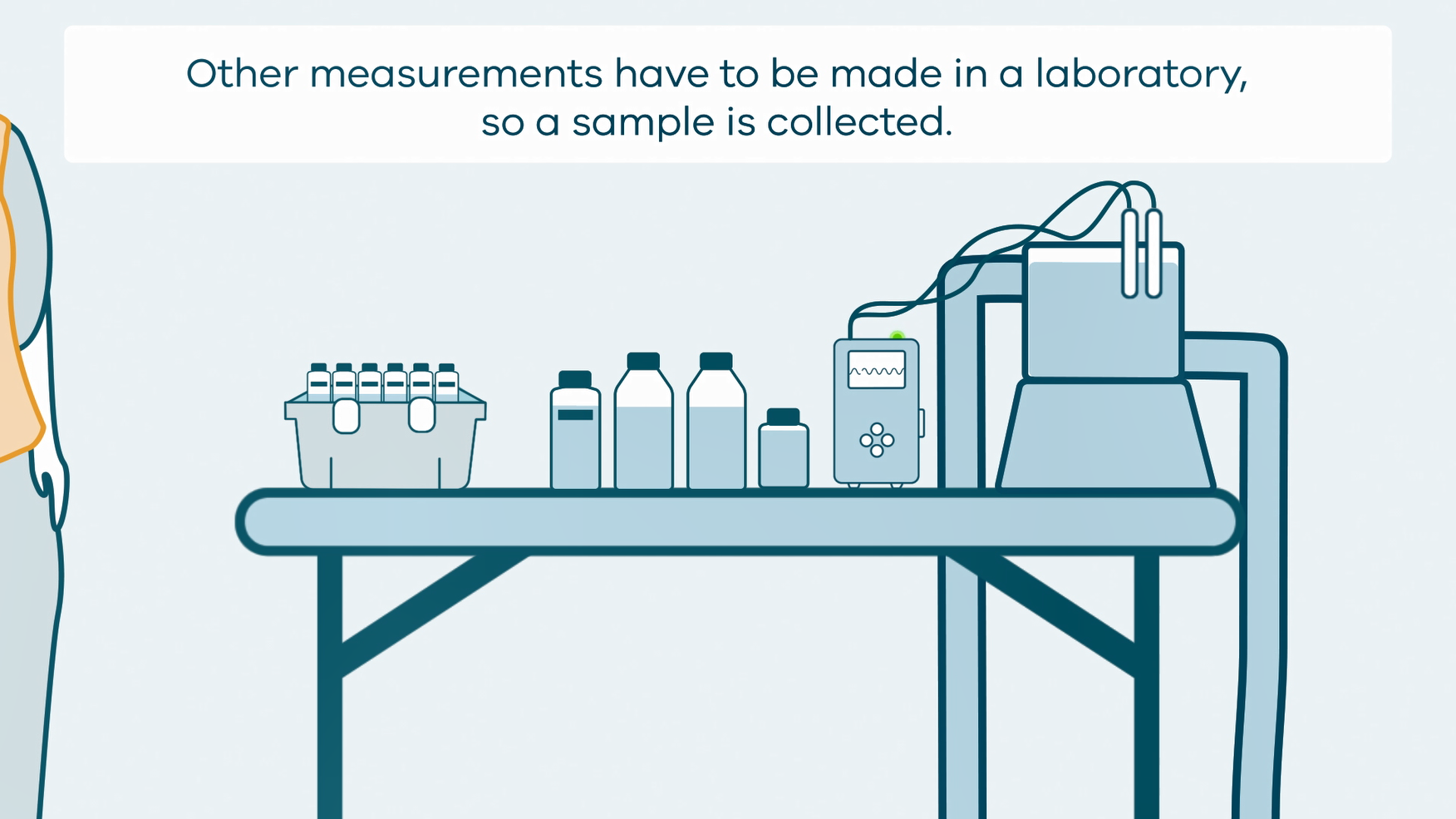
This animation shows how groundwater sampling is conducted. It is part of a series of Field Activity Technique Engagement Animations. The target audience are the communities that are impacted by GA's data acquisition activities. There is no sound or voice over. The 2D animation includes a simplified view of what groundwater sampling equipment looks like, what the equipment measures and how scientists use the data.
-
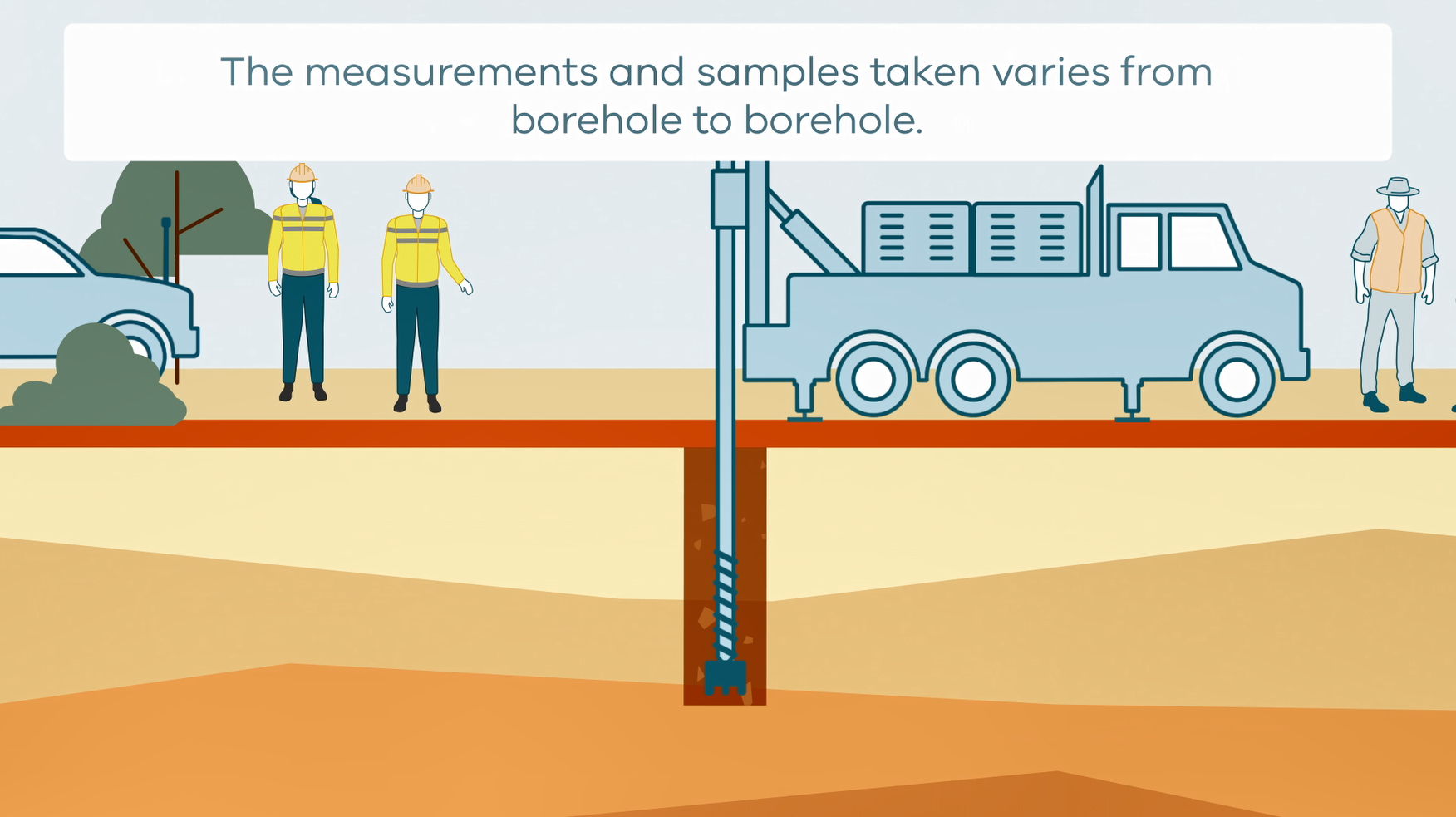
This animation shows how stratigraphic drilling is conducted. It is part of a series of Field Activity Technique Engagement Animations. The target audience are the communities that are impacted by GA's data acquisition activities. There is no sound or voice over. The 2D animation includes a simplified view of what stratigraphic drilling looks like, what measurements and samples are taken, and how scientists use the data.
-
This animation shows how Airborne Electromagnetic Surveys Work, when conducted by a rotary wing (helicopter) aircraft. It is part of a series of Field Activity Technique Engagement Animations. The target audience are the communities that are impacted by our data acquisition activities. There is no sound or voice over. The 2D animation includes a simplified view of what AEM equipment looks like, what the equipment measures and how the survey works.
-
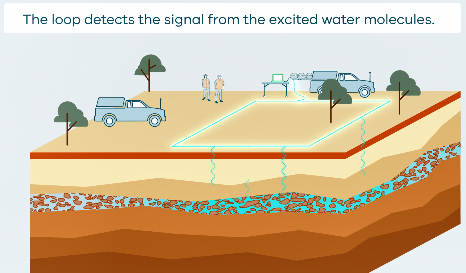
This animation shows how Surface Magnetic Resonance (SMR) Surveys are conducted. It is part of a series of Field Activity Technique Engagement Animations. The target audience are the communities that are impacted by GA's data acquisition activities. There is no sound or voice over. The 2D animation includes a simplified view of what SMR equipment looks like, what the equipment measures and how scientists use the data.
-
<div>Report on expression of interest, assessment and identification process of case studies to be included in the Exploring for the Future Geoscience Knowledge Sharing Project Remote Community Education Module and Building Relationships with Aboriginal Peoples Modules. The Geoscience Knowledge Sharing Project is a pilot study to discover best practices to improve engagement with non-technical stakeholders. </div>